Phantom Islands
For centuries, mapmakers drew islands that did not exist. These phantom islands appeared on charts and atlases, were copied from one generation to the next, and in some cases remained on maps for hundreds of years before anyone confirmed they were never there.
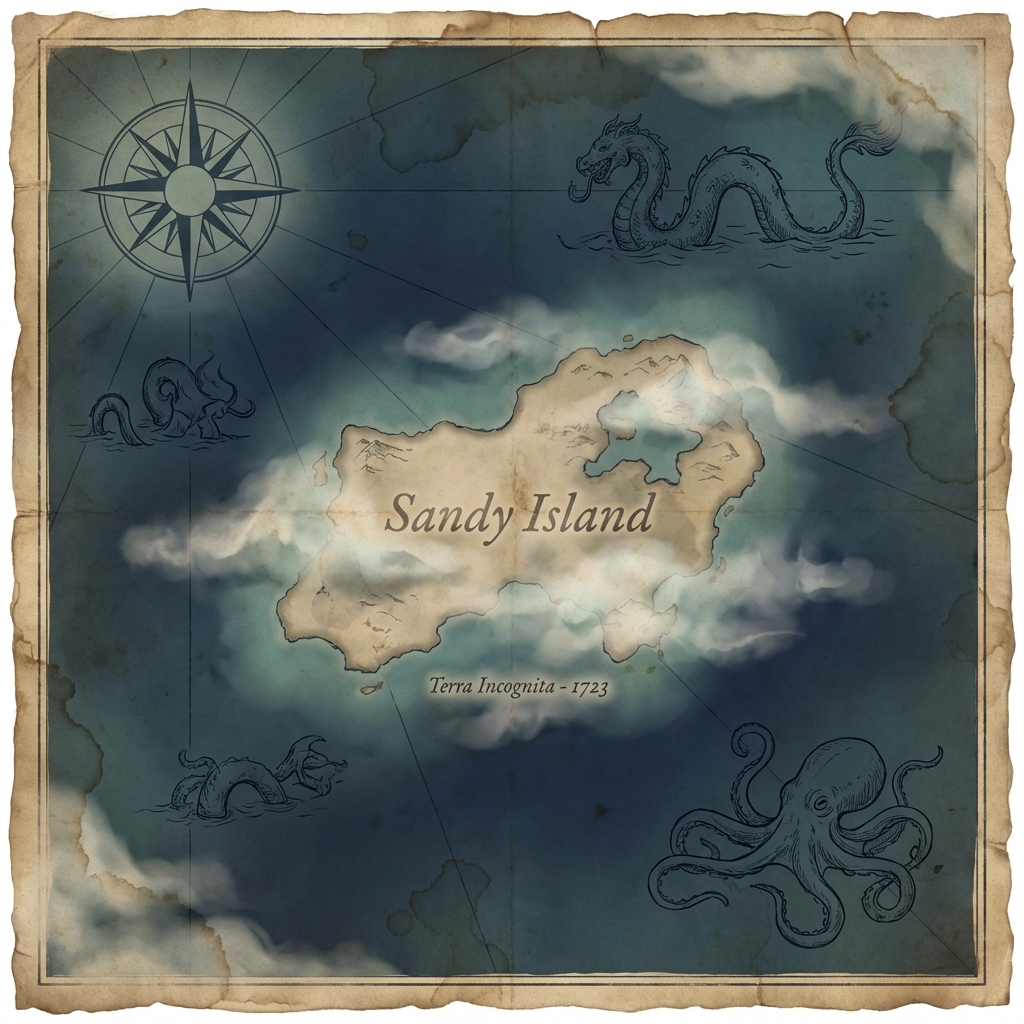
Sandy Island appeared on nautical charts in 1876, positioned in the Coral Sea west of New Caledonia. It was described as roughly 15 miles long and 3 miles wide, substantial enough to be included on Google Maps. In 2012, an Australian research vessel sailed to the coordinates and found only open ocean. The island had never existed. Twentieth-century maps had occasionally labeled it "ED"—existence doubtful—but nobody had bothered to check until then.
Hy-Brasil was more persistent. First mapped in 1325 off the west coast of Ireland, this phantom island supposedly appeared from the Atlantic mist for one day every seven years. Irish mythology held that a king held court there during its brief emergences. The island shifted position on successive maps, as cartographers couldn't agree on its location, but it continued appearing on charts until 1873, when it was finally removed from British Admiralty publications.
Bermeja caused actual geopolitical consequences. This small island off the Mexican coast appeared on maps from 1539 onward, described as having reddish-blonde soil across roughly 80 square kilometers. When Mexico and the United States negotiated oil exploration rights in the Gulf of Mexico in the 2000s, Bermeja's existence mattered: the island would have extended Mexican territorial waters significantly. Expeditions in 1997 and 2009 found nothing. The island had been on maps for 400 years without anyone verifying it, and its absence reportedly cost Mexico rights to 22.5 billion barrels of oil.
Mapmaking was a competitive business, and cartographers were often desperate to fill blank spaces with the latest information from returning sailors. Rumors, misidentifications of fog banks or icebergs, navigational errors using dead reckoning, and outright fabrications all found their way onto maps. Once an island appeared, no cartographer wanted to be the one to erase it without confirmation. So the phantoms persisted.